Robotic Total Stations have changed the way the industry works. As a company, we’ve watched the industry evolve. The tools we use to set out, draw and survey have grown and digitised over the years.
Although we’ve previously discussed the differences between robotic vs. mechanical total stations and the foundations for surveying – it’s time to look forward. We’re thinking about the future of surveying and surmising the importance of the robotic total station in the industry.
In this blog, we’ll cover the basics. Starting with the evolution of surveying technology, right up to portability, 5G and IoT in surveying. We’ll talk about the evolution of surveying technology, applications for the digitised tool and the robotic revolution. Uncovering what role we think they’ll play in the future of surveying.
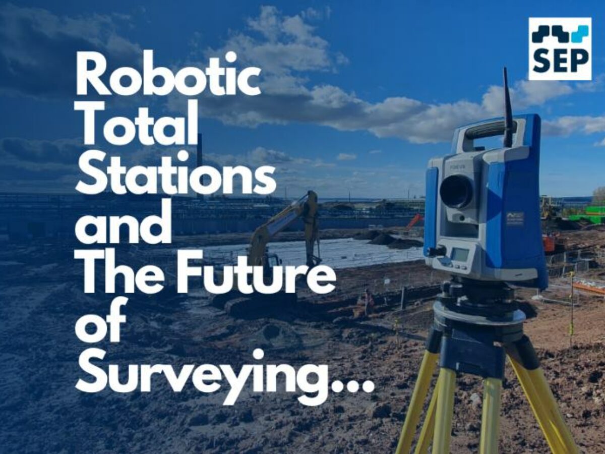
What is a Robotic Total Station?
A robotic total station is a sophisticated surveying instrument used in the field of geomatics and land surveying. It combines the functions of a traditional total station, which measures angles and distances, with robotics and automation to enhance its capabilities.
Evolution of surveying technology
As previously discussed in our deep dive into the history of mechanical total stations, and the foundations they laid for robotic technology; “The integration of advanced technologies, such as robotic total stations combining GPS capabilities, has pushed the boundaries of precision, efficiency, and safety in surveying operations.”
We’ve watched as these imperative tools, theodolites and distance measurement equipment joined forces but also became automated to further improve accuracies and productivity in the field.
Increased efficiency and accuracy
These combined tools increase accuracy and efficiency in surveying projects like no other. Here are just some ways robotic total stations increase efficiencies:
- Automated Target Tracking – by automatically tracking and locking onto surveying targets, such as prisms or reflective markers, the need for a surveyor to manually aim and align the instrument is eliminated
- Remote Operation – surveyors can control them remotely using a controller, or specific software on a tablet or computer, meaning they can work more efficiently and safely in challenging or hazardous environments
- Real-Time Data Collection – by collecting data in real-time and displaying it on a screen, surveyors can immediately assess the quality and completeness of the data, enabling on-the-fly adjustments and corrections
- Data Integration – they can be integrated with other surveying and geospatial technologies, such as GPS or GNSS, allowing for seamless data fusion and improving results by combining data from multiple sources
- Reduced Downtime – since they can operate continuously with minimal breaks, surveying projects can progress more rapidly, relieving the need for frequent manual adjustments or repositioning
- Improved Documentation – they can generate detailed reports and documentation automatically, including measurement data, timestamps and other relevant information, which helps in quality control and project management
Overall, robotic total stations leverage automation, precision technology, and real-time data processing to increase the efficiency and accuracy of surveying tasks. Not only saving you time and resources but also providing more reliable results and precise survey data.

Health and Safety risk assessment and management
Ensuring the safety of surveyors and minimising health risks is paramount in any fieldwork, and Robotic Total Stations play a crucial role in risk assessment and management. These sophisticated instruments contribute significantly to preemptive identification and mitigation of potential hazards. Here are just some ways in which Robotic Total Stations enhance overall workplace safety:
- Hazard Identification – equipped with advanced sensors and automation capabilities, these tools excel at identifying potential hazards in surveying environments. Whether it’s uneven terrain, unstable ground conditions, or other physical obstacles. They can swiftly detect and analyse the surroundings, providing valuable data for risk assessment.
- Remote Operation for Hazardous Environments – one key advantage is the ability to operate them remotely. Surveyors can control the instruments from a safe distance using data controllers, tablets, or computers. This feature is particularly beneficial in challenging or hazardous environments, such as construction sites with ongoing activities or areas with potential exposure to harmful substances.
- Automated Target Tracking for Safety – the automated target tracking feature of robotic total stations eliminates the need for surveyors to manually aim and align the instrument. By autonomously tracking and locking onto surveying targets like mini prisms or reflective markers, the risk of human error is minimised, contributing to more accurate and safer data collection.
- Minimising Field Exposure – robotic total stations reduce the time surveyors spend in the field, minimising physical exertion and exposure to potential risks. Surveyors can efficiently complete tasks without prolonged exposure to adverse conditions.
- Surveying Hazardous Areas – in scenarios where human safety is a concern, such as toxic environments or unstable grounds, these tools become indispensable. They can survey these areas without putting human surveyors at risk, providing precise measurements and data for analysis without direct human involvement.
- Real-time Data for Informed Decision-Making – the real-time data collection feature allows surveyors to assess the quality and completeness of data instantly. This capability enables on-the-fly adjustments and corrections, ensuring that potential safety concerns are addressed promptly during the surveying process.
- Enhanced Documentation for Safety Compliance – contributing improved documentation and generating detailed reports automatically, not only aids in project management but also serves as valuable documentation for safety compliance.
The integration of Robotic Total Stations in surveying practices goes beyond efficiency and precision—it significantly enhances health and safety in the field. By proactively identifying, assessing, and mitigating potential risks, these instruments empower surveyors to conduct their work with confidence, ensuring a safer and more secure working environment.
What are the applications of Robotic Total Stations?
Land Surveying – One of the most fundamental applications of robotic total stations. In land surveying, these instruments accurately measure and map the dimensions, boundaries, and topographical features of parcels of land. Robotic total stations’ precision, efficiency and real-time data collection make them essential tools for tasks like property boundary surveys, land subdivisions, and land use planning.
Construction Site Monitoring – With continuous tracking and measurement of various parameters during construction projects, robotic total stations play a critical role by providing real-time data on site conditions, progress, and accuracy of construction work, helping construction teams ensure buildings, roads, and structures are constructed according to design specifications and within safety standards.
Infrastructure Development – Encompassing the planning, design, and construction of essential facilities and systems, including roads, bridges, railways, airports, utilities, and more, robotic total stations are used extensively to survey and lay out infrastructure projects with high precision. They help engineers and designers make informed decisions, control costs and ensure the durability and safety of infrastructure assets.
Mining and Quarrying – Precise measurement and monitoring are crucial for safety, efficiency, and resource extraction. Robotic total stations are employed to accurately survey mining sites, track the movement of earth, minerals, and materials, and calculate volumes of extracted resources, assisting in optimising mining operations and maintaining the stability of quarry sites.
Integration with Geographic Information Systems – GIS are tools for capturing, storing, analysing, and visualising spatial data. Robotic total stations can be integrated with GIS to enhance the quality and accuracy of geospatial information. This integration allows surveyors and GIS professionals to collect precise location data and update GIS databases in real-time, facilitating informed decision-making in urban planning, natural resource management, and emergency response.
These applications highlight the versatility and importance of robotic total stations in various industries. They not only improve the efficiency and accuracy of data collection but also contribute to the successful planning, development, and management of land, construction projects, infrastructure, and natural resources.
How Robotic Total Stations may evolve over time
The evolution of robotic total stations over time is an exciting prospect driven by advancements in technology and the changing needs of industries that rely on surveying and geospatial data. Here are some ways in which robotic total stations may evolve in the future:
- Miniaturisation and Portability: As technology continues to miniaturise, we can expect robotic total stations to become smaller and more portable. This will make them easier to transport to remote or challenging surveying locations and increase their usability in various applications.
- Improved Automation and AI Integration: Robotic total stations may become even more automated and capable of autonomously performing complex surveying tasks. Integration with artificial intelligence (AI) algorithms could enable them to recognise and classify survey targets, analyse data in real-time, and make decisions, reducing the need for constant human intervention.
- Enhanced Connectivity: Future models may have improved connectivity features, including better compatibility with the latest communication networks such as 5G. This would enable seamless data transfer and remote control over longer distances, expanding their operational range.
- Advanced Data Processing: With the increasing importance of data analytics, robotic total stations may incorporate more powerful onboard data processing capabilities. This could include the ability to generate 3D models and conduct advanced spatial analysis directly within the instrument.
- Integration with Other Technologies: Robotic total stations are likely to continue integrating with other technologies like drones and autonomous vehicles. These collaborations could result in more efficient surveying workflows and the ability to cover larger areas in less time.
- Environmental Sustainability: There will likely be a growing emphasis on environmentally friendly design. Future models may use energy-efficient components, incorporate renewable energy sources, and be designed with sustainability in mind.
- Higher Precision and Accuracy: Precision and accuracy will remain paramount. They may feature even more advanced measurement technology to achieve higher levels of precision, particularly in critical applications like construction and infrastructure development.
- User-Friendly Interfaces: The user interfaces may become more intuitive and user-friendly, making them accessible to a broader range of professionals and reducing the learning curve for operators.
- Extended Battery Life: To support longer work hours in the field, future models may feature improved battery technology, allowing for extended operation without frequent recharging.
- Enhanced Durability and Robustness: Given that these instruments are often used in challenging environments, future models may be designed to be more durable, weather-resistant, and able to withstand harsh conditions.
- Affordability and Accessibility: As technology evolves, the cost of manufacturing robotic total stations may decrease, making them more accessible to a wider range of users, including smaller businesses and research institutions. To mitigate this cost, SEP offers a survey equipment hire service that makes projects more affordable.
The evolution of robotic total stations will likely continue to align with the growing demand for efficiency, accuracy, and automation in surveying and geospatial applications. These advancements will empower professionals in fields such as land surveying, construction, infrastructure development, and environmental management to work more effectively and make more informed decisions based on precise, real-time data.

The Robotic Total Station revolution
Whilst there might not be robots taking over the world, there is a high chance our workload will be streamlined with the help of AI. Catapulted by increased connectivity, integrated technologies and advanced data processing. We’ll see environmentally designed models with a more robust, durable approach, and portable capabilities.
The transformative potential of robotic total stations in surveying is limitless and shows with the innovation of robotic tools themselves. If you want to learn more about robotic total stations and their capabilities, visit our blog for more, or find out how to get the most out of your robotic total station today.
For more detailed information on your robotic total station, or personalised advice on what SEP can do for you – contact us any time.