Earlier this year, Trimble announced the release of the Trimble X9 3D laser scanner, the company’s latest reality capture solution designed for surveying, construction, and engineering professionals. And as our recent collaboration with KOREC Group means the X9 is something we can now offer our customers, both for sale and to hire, we thought we’d take a closer look.
The Trimble X9 3D laser scanner – an overview
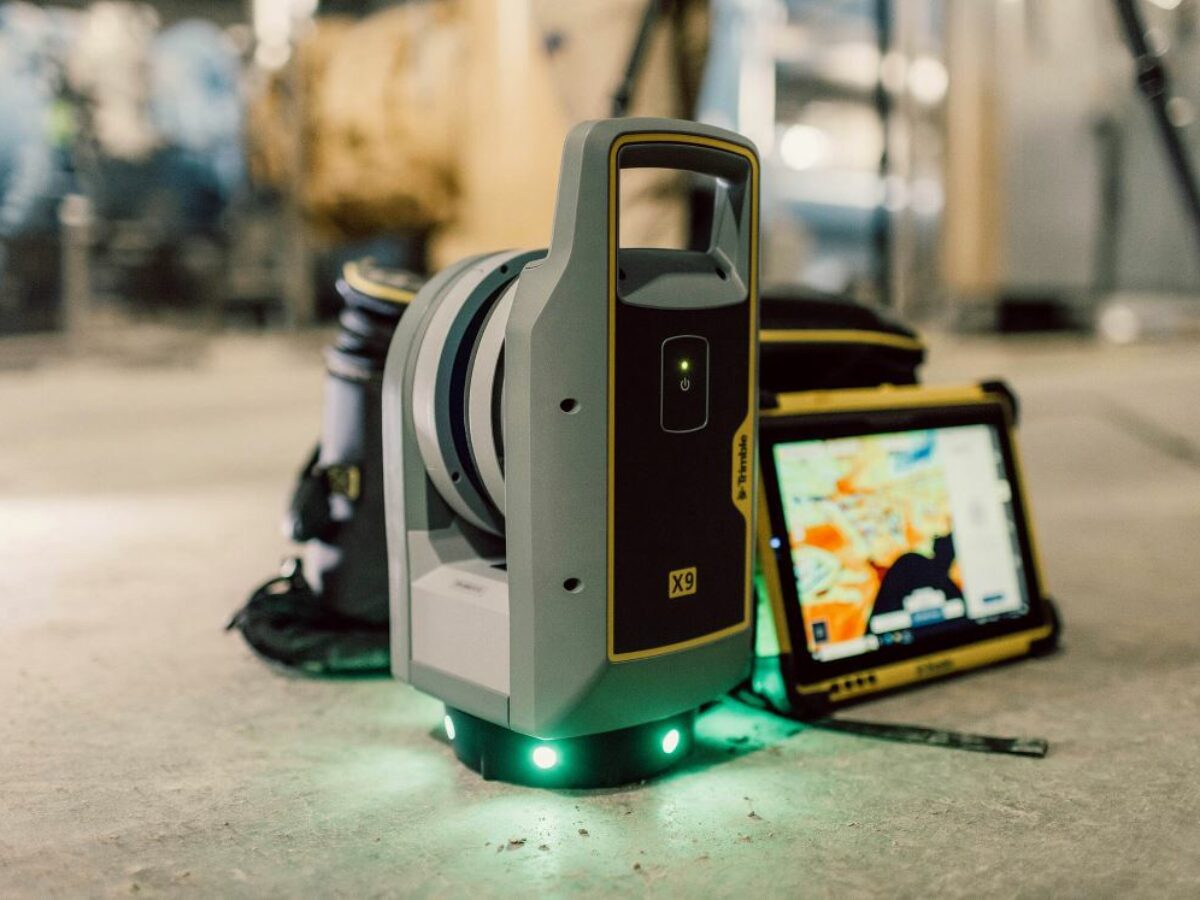
The Trimble X9 is a high-precision 3D laser scanning system with unparalleled accuracy, speed and efficiency.
This is the latest iteration of laser scanning technology from Trimble, which they say is “engineered to enhance performance in more environments while leveraging innovations such as the Trimble X-Drive technology for automatic instrument calibration, survey-grade self-leveling, and laser pointer for georeferencing.”
Combining state-of-the-art hardware and software, the X9 delivers longer scanning range, higher accuracy, shorter scan times, and exceptional sensitivity. These advancements make it an ideal solution for capturing dark or reflective surfaces which can so often cause problems when it comes to collecting data.
Advantages of the Trimble X9
Speed, efficiency and accuracy: The Trimble X9’s advanced scanning capabilities allow users to capture vast amounts of data in a fraction of the time required by older equipment, reducing field time and accelerating project completion. To be more specific, the X9 includes high-speed scanning up to one million points per second to go with a range of up to 150 meters and an accuracy of two millimeters.
High accuracy: with an accuracy of just 2mm, the X9 ensures that users obtain accurate data even in complex environments.
Ease of use: Despite its sophisticated technology, the X9 is designed with user-friendliness in mind. It also comes in at just over 6kg including the battery, and comes with three batteries, each lasting up to 3.5 hours on a full charge.
Integration with existing workflows: Trimble’s commitment to compatibility means that the X9 integrates seamlessly with Trimble software to ensure an easy and efficient workflow. Data collected from the X9 can be delivered from Trimble Perspective, the company’s in-field point cloud software, to back-office software like Trimble Realworks, Trimble Business Center, or SketchUp and Tekla. Data does not have to go to Trimble software, either, as it can be exported to industry-standard formats for application-specific deliverables.
In a nutshell
Trimble X9 features
- High-speed scanning – up to 1 million points per second
- Better range, angular accuracy and data quality
- Self-calibrating for dependable data, every scan
- Survey grade self-levelling
- IP55 environmental protection
- Flexible operation with tablet, phone or one-button workflow
- Works seamlessly with Trimble Perspective software
A multitude of applications
Its power and versatility means the X9 lends itself to a wide variety of different applications, such as;
- Topographic and general surveys
- Civil Infrastructure
- Industrial surveys
- Forensics
- Cultural Heritage
- Digital Twins
- Tank Calibration & Inspection
- Ship Building surveys
If you would like more information about this product, please get in touch and one of our team will be more than happy to help.
